Melbourne has recorded its heaviest daily rainfall since April 2024, with 47.8mm at Olympic Park since 9am Thursday and up to 25mm falling in a single hour on Thursday afternoon. Flood watches are current across central and eastern Victoria. Heavy rain hit the city on Thursday and continued into Friday, bringing flash flooding to creeks and under bridges. Parts of eastern Victoria could see 100 to 150mm over the coming days, the Bureau of Meteorology warns, with more rain expected before the low-pressure system moves offshore.
With more heavy rain forecast across Victoria, do you know whether your area is under a flood watch?
Choose an answer, then select Vote.
How Much Fell
The Bureau of Meteorology’s reading at Olympic Park, 47.8mm since 9am Thursday, is the city’s highest daily total since April 2024, and up to 25mm of it fell in a single hour. Around Ballarat and Melbourne, falls of 20 to 50mm were recorded. The CBD went dark about 3pm that day. The Victoria State Emergency Service described Thursday as one of the wettest October days in several years.
The Response
The Victoria State Emergency Service had received about 200 calls for help since midday Thursday, including 71 for building damage, 50 for flooding and 44 for fallen trees. Crews had carried out six water rescues alongside Victoria Police. “It’s been a very hectic last 24 hours,” state duty officer Shane McBride said. “The number that’s really scary at the moment is six flood rescues we’ve had.” He urged people not to drive into floodwater, and said the service’s advice to never enter it stands.
Power and Local Impacts
About 3,000 Powercor customers in the Heathcote area lost power during the overnight storms, ABC News reported, and minor flooding was evident on a street in Sale.
The Regions
Gippsland dairy farms were flooded near Maffra, and farmer Nicole Saunders, who milks 600 cows, spent the day moving stock to higher ground. She said Sunday could be peak flooding for the district. Further rain and thunderstorms are forecast for Gippsland and the north-east, with the highest risk of intense rainfall over the Otways and the Strzelecki Ranges, the Bureau says. Western Victorian grain growers, by contrast, welcomed the rain as ideal for grain fill.
What Is Still Coming
A flood watch is current for catchments across central and eastern Victoria, the Bureau says. Parts of eastern Victoria could see 100 to 150mm over the coming days, with another 50 to 80mm or more possible in the Otways on Saturday, 9News reports. Conditions are expected to ease on Sunday as the low moves offshore, but peak flooding may arrive in Gippsland first.
The rain follows south-east Australia’s second-driest September on record, and it caps a year of weather extremes that has run from January’s solar storm to this week’s storms.
More Rain Before It Eases
More rain and thunderstorms are forecast for Friday and Saturday, and the flood watch stays in place across central and eastern Victoria. Peak flooding is possible in Gippsland on Sunday before conditions ease as the low-pressure system moves offshore. The SES advice is unchanged: never enter floodwater, and never drive into it.
Sources: Bureau of Meteorology, rainfall observations and Victorian flood watch statements, 1-2 October 2026; Victoria State Emergency Service, response figures and safety warnings, 2 October 2026; ABC News, “Dairy farm flooded, but grain growers rejoice as Victoria settles in for wet weekend”, 2 October 2026 – https://www.abc.net.au/news/2026-10-02/wet-weather-flash-flooding-victoria-spring-rain/107219510; 9News, “Millions to cop a drenching across south-east Australia”, 2 October 2026 – https://www.nine.com.au/australia-news/millions-to-cop-a-drenching-across-south-east-australia-20261002-p612bc.html
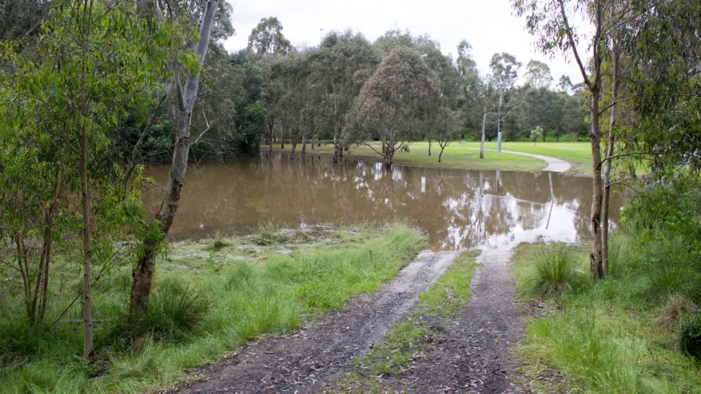
Photo: Philip Mallis, CC BY-SA 2.0, via Wikimedia Commons.
Illustrative: floodwater on the Koonung Creek trail at Yarra Flats Reserve in Melbourne’s east, photographed in November 2022. This photograph is not from this week’s storm.